


CAVE CREEK Voting District, Maricopa County, Arizona
About
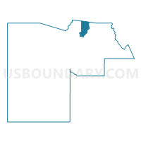
Outline

Summary
| Unique Area Identifier | 524901 |
| Name | CAVE CREEK Voting District |
| County | Maricopa County |
| State | Arizona |
| Area (square miles) | 103.54 |
| Land Area (square miles) | 103.52 |
| Water Area (square miles) | 0.02 |
| % of Land Area | 99.98 |
| % of Water Area | 0.02 |
| Latitude of the Internal Point | 33.93104140 |
| Longtitude of the Internal Point | -111.90346400 |
Maps


Graphs
Select a template below for downloading or customizing gragh for CAVE CREEK Voting District, Maricopa County, Arizona


Neighbors
Neighoring Voting District (by Name) Neighboring Voting District on the Map
- Canyon Voting District, Yavapai County, AZ
- CAREFREE Voting District, Maricopa County, AZ
- DESERT HILLS Voting District, Maricopa County, AZ
- DOVE VALLEY Voting District, Maricopa County, AZ
- LONE MOUNTAIN Voting District, Maricopa County, AZ
- NEW RIVER Voting District, Maricopa County, AZ
- RANCHO PALOMA Voting District, Maricopa County, AZ
- STAGECOACH Voting District, Maricopa County, AZ
- TERRAVITA Voting District, Maricopa County, AZ
Top 10 Neighboring County Subdivision (by Population) Neighboring County Subdivision on the Map
- Deer Valley CCD, Maricopa County, AZ (258,464)
- Tonto National Forest CCD, Maricopa County, AZ (9,713)
- Cordes Lakes-Mayer CCD, Yavapai County, AZ (6,550)
Top 10 Neighboring Place (by Population) Neighboring Place on the Map
- Phoenix city, AZ (1,445,632)
- Scottsdale city, AZ (217,385)
- New River CDP, AZ (14,952)
- Cave Creek town, AZ (5,015)
- Carefree town, AZ (3,363)
Top 10 Neighboring Unified School District (by Population) Neighboring Unified School District on the Map
- Deer Valley Unified District, AZ (239,044)
- School District Not Defined, AZ (69,809)
- Cave Creek Unified District, AZ (56,235)
- Mayer Unified District, AZ (5,679)
Top 10 Neighboring State Legislative District Lower Chamber (by Population) Neighboring State Legislative District Lower Chamber on the Map
- State House District 4, AZ (294,239)
- State House District 6, AZ (219,170)
- State House District 7, AZ (190,272)
- State House District 8, AZ (185,419)
Top 10 Neighboring State Legislative District Upper Chamber (by Population) Neighboring State Legislative District Upper Chamber on the Map
- State Senate District 4, AZ (294,239)
- State Senate District 6, AZ (219,170)
- State Senate District 7, AZ (190,272)
- State Senate District 8, AZ (185,419)
Top 10 Neighboring 111th Congressional District (by Population) Neighboring 111th Congressional District on the Map
- Congressional District 1, AZ (774,310)
- Congressional District 3, AZ (707,919)
- Congressional District 5, AZ (656,833)
Top 10 Neighboring Census Tract (by Population) Neighboring Census Tract on the Map
- Census Tract 6107, Maricopa County, AZ (7,193)
- Census Tract 6124, Maricopa County, AZ (6,840)
- Census Tract 15, Yavapai County, AZ (6,550)
- Census Tract 101.02, Maricopa County, AZ (4,640)
- Census Tract 6125, Maricopa County, AZ (4,306)
- Census Tract 304.01, Maricopa County, AZ (4,283)
- Census Tract 304.02, Maricopa County, AZ (3,895)
- Census Tract 6130, Maricopa County, AZ (2,945)
- Census Tract 6131, Maricopa County, AZ (2,640)
Top 10 Neighboring 5-Digit ZIP Code Tabulation Area (by Population) Neighboring 5-Digit ZIP Code Tabulation Area on the Map
- 85086, AZ (40,495)
- 85331, AZ (26,960)
- 85024, AZ (22,898)
- 85266, AZ (11,406)
- 85262, AZ (11,275)
- 85087, AZ (7,708)
- 85377, AZ (3,051)
- 85324, AZ (2,886)